

1878 – 1880
Emergence of a Mining Community1878 – 1880 Emergence of a Mining Community Van Anda Texada Island
In 2026, if you ask about Texada Island, this is the description you will get*.
Texada Island is located approximately 120 kilometres northwest of Vancouver, BC, and is easily accessible by air and ferry. The island has a well-developed infrastructure, including services, tidewater access, and transportation methods. The town has a population of around 1200 people according to the 2021 census. But in the 1880’s, it was the site of a major gold rush; from 1898 to 1905, which were the peak boom years, it had a revolving population of ~3,000–4,000+ people.
Between 1906 and 1915, the boom turned to bust, marking the beginning of a decline. During this period, the population fluctuated between approximately 2,000 and 1,000 residents. The main causes of the decline included failing mines with short-lived yields, poorly funded claims, and other contributing factors. Additionally, significant fires devastated Van Anda repeatedly from 1910 to 1917. In the years following, from 1915 to 1930, the post-boom collapse saw the population vary between around 500 and 800 residents.
From the 1930s up to the 1970s, there was an industrial plateau and as the demand for ore fluctuated, so did the population of ~400–700. Most lived in Blubber Bay, which built a small company town of 35 families according to the census in 1970; however, other communities such as Van Anda ( Vanada ) and Gillies Bay had a small population as well.
Historically, Texada Island was a focal point in the mid to late 1870s when stories of ore discoveries emerged and spread.
The land grants issued in 1878 and 1879 on Texada Island showcase an early phase of British Columbia’s land administration following Confederation. During this period, the provincial government sought to implement a formal property system throughout coastal territories that had long been governed by indigenous practices. Among the most notable of these grants was the one awarded to Henry Evelyn Sturt, whose holdings on Texada Island later inspired the naming of Sturt Bay, a sheltered inlet on the island’s western shore. The archival records related to these grants reveal the tension between the government’s ambitions and the environmental realities of the region.
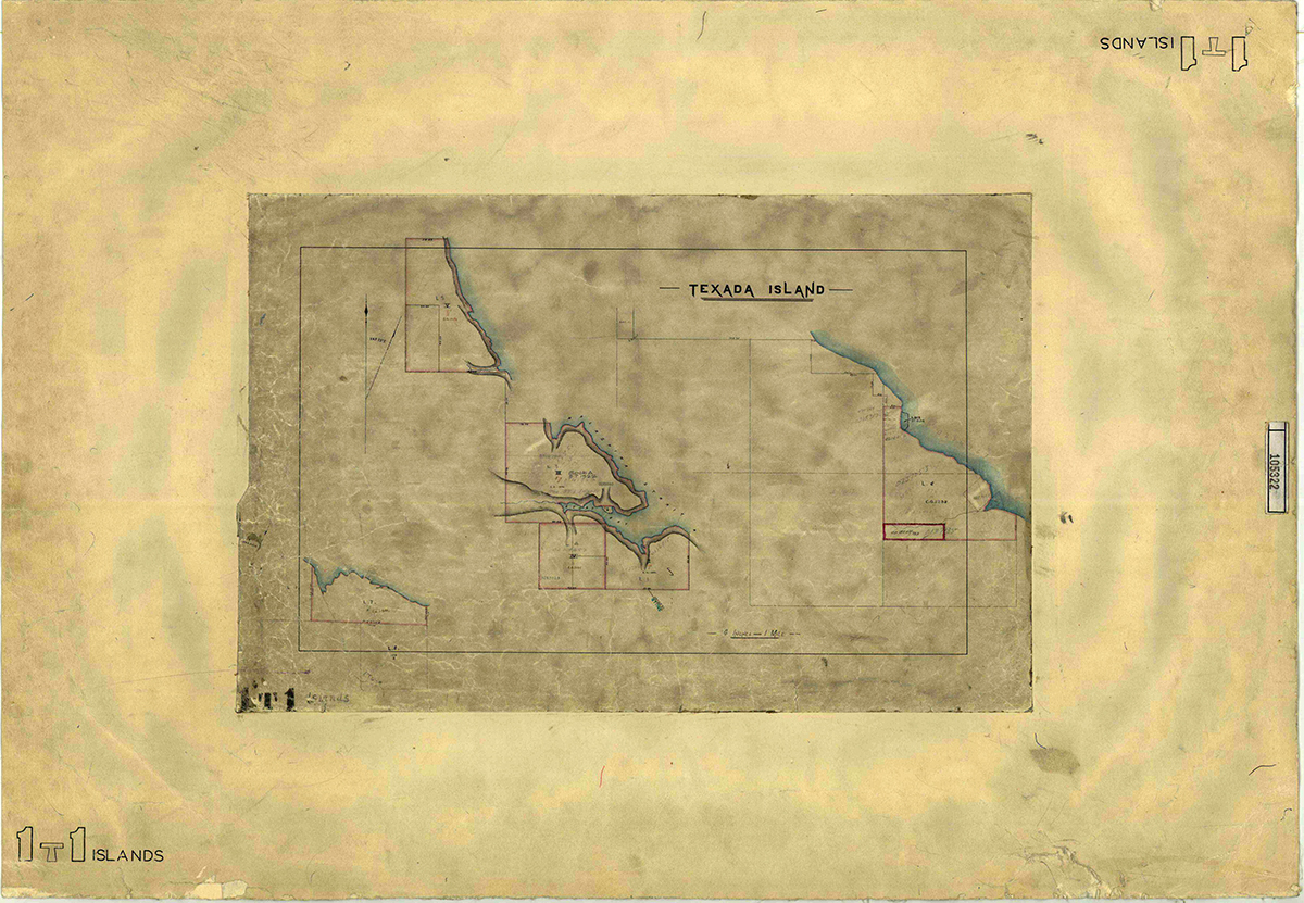
In the late 1870s, surveyors attempted to represent Texada’s irregular coastline, steep forested slopes, and mineral-rich interior in standardized lots. Their maps, created at scales such as four inches to the mile, offered a geometric framework that the Crown used to issue grants the following year. However, the apparent precision of these maps concealed the practical difficulties of surveying in the dense coastal terrain, where weather, vegetation, and topography often resisted rigid cadastral measurements.
Settlers who received these grants encountered landscapes that differed significantly from their cartographic representations. Henry Evelyn Sturt’s parcels, though legally defined by measurements, comprised rugged shorelines, dense timber, and complex geological formations. His presence on the island, along with the subsequent naming of Sturt Bay, reflects the Crown’s desire to encourage settlement and the substantive influence that individual settlers could have on local place names.

1878 Henry Evelyn Sturt Lot 1 Survey (click on image for title transfer doc)

1879 Samuel Robinson Lot 3 Survey (click on image for title transfer doc)

1879 Samuel Robinson Lot 5 Survey (click on image for title transfer doc)

1879 Henry Evelyn Sturt Lot 2 Survey (click on image for title transfer doc)

1880 Joseph Spratt Lot 6 Texada Survey (click on image for title transfer doc)

1880 Thomas Shotbolts Lot 7 Texada Survey (click on image for title transfer doc)
Directly beside Mr. Sturt’s claim of Lot 1 was Samual Robinson, who in 1879 made his claim of Lot 3, which was directly across from Mr. Sturt’s main claim, which surrounded the land and most of the north side of Sturt Bay. Mr. Robinson then made a claim for Lot 4, which sat south of the Lot and beside Mr. Sturt’s, and he subsequently applied for and received Lot 5.
The last remaining land in Sturt Bay was an outstanding claim for Lot 2, located opposite Lot 1. Mr. Sturt finally received approval for this land claim in November 1879. In 1880, Lots 6 and 7 were filed for and granted to Mr. Spratt.
Lot 1, granted on October 3, 1878, is now the land on which Van Anda is located. Meanwhile, on the northern tip of Texada, Robert W Gordon received Lot 12, sitting in Blubber Bay on the west side,
Overall, the Texada Island land grants of 1878–79 illustrate the intersections of colonial administration, settler activities, and the coastal environment during a formative period in the province’s land tenure history.

1880 – 1881 Charles Edward Pooley Lot 8 Texada Survey (click on image for title transfer doc)

1880 Samuel Robinson Lot 4 Texada Survey (click on image for title transfer doc)

1903 Lots 11 and 12 Sold by Taxes Click to enlarge
Van Anda on Texada is named after Carrie Van Anda, the wife of Ed Blewett, who was the president of Van Anda Copper & Gold Co. The community originally consisted of two separate town sites: Van Anda and Texada City. Over time, these two towns merged into one. The name honours the historical significance of Carrie Van Anda in the development of the area. Ed Blewett was married to Carrie Van Anda on April 4, 1870, in Fremont, Nebraska, and remained married until she died in 1927.
Ed Blewett owned Van Anda Copper and Gold Mining Company, which owned 840 acres on the northeast side of the island. The company’s president, Edward Blewett, was a prominent capitalist and miner from Seattle, and he led the exploration of these Canadian sites. The area became active in 1876 when Harry Trim, a local whaler, discovered iron ore. This ore was used to build battleships; however, attention quickly shifted to gold and copper after their discovery in 1880. The mining boom was short-lived, as the minerals were localized. Still during that period, the small town of Van Anda experienced significant growth, including the establishment of the largest opera house north of San Francisco at the time.
The Van Anda Copper and Gold Mining Company had several shafts, with the main shaft collar located on Lots 521 and 522, about half a mile east-southeast of Vananda Cove. These shafts produced a significant amount of high-quality ore, which garnered attention in mining magazines. As a result, these publications informed others seeking riches about the opportunities available on Texada Island.
CLICK ON IMAGE BELOW TO EXPAND

1891 – 1906 Vananda Gold Ltd (click on image for 3 page pdf of site and underground map)